Field Research Around Qaanaaq Coast, Northwestern Greenland
Research teams of the Research Program on Coastal Environments in the fields of marine, glaciers/ice sheet, land/atmosphere, humanities, or others conduct a variety of research observations around Qaanaaq in northwest Greenland from July to September 2022. In addition to the observations in cooperation with local researchers and residents, a workshop with the local community is also planned. During this stay, some of the research projects selected for the Call for Complementary Research Projects of Priority Subject 1 will also conduct their research through collaboration. Please enjoy reports from the research teams along with photos.
Table of Contents
Material Culture Survey and Workshop in Siorapaluk Village, Northwestern Greenland(2022/12/22)New!
Survey of Marine Ecosystem in The Coastal Area of NW Greenland – Marine Mammals and Seabirds(2022/8/25)
Workshop at the Qaanaaq Village, Northwestern Greenland(2022/8/25)
Survey for Marine Ecosystem in the Coastal Area of NW Greenland – Fishing Gear and Acoustics –(2022/8/19)
Landslide Survey on Fjord Slopes in the Coastal Area of NW Greenland(2022/8/3)
How Does Meltwater Come Out from a Glacier in Greenland?(2022/7/27)
Material Culture Survey and Workshop in Siorapaluk Village, Northwestern Greenland
Writer:Ryo Kusaka (Hokkaido University)
From July to August 2022, we stayed in Siorapaluk village for two weeks to survey the actual use of dogsleds, collect sleds, and document the whip-making process. We also held a workshop with village residents to introduce our research on the ArCS II Research Program on Coastal Environments, including a survey of marine mammals.
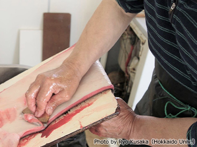
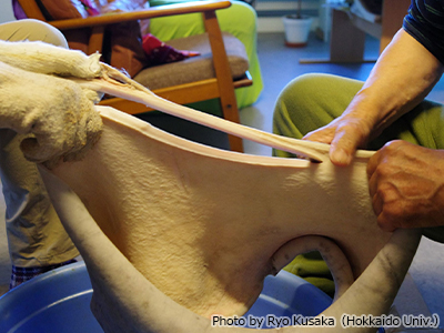
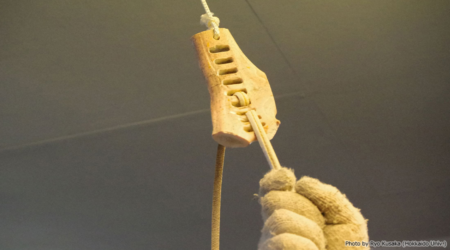
The Greenland Inuit have long used dog sleds for winter transportation. When connecting the sled skis to the base, ropes, rather than nails, are used to secure the structure, making it flexible and unbreakable. Today, they use these leather straps only for the whips of their dog sleds (they also use nylon ropes). One reason for this may be that the flexibility of the rope can be freely controlled by tanning. In this study, we documented making this dog sled whip. The whip is completed through a long process of stripping the fur of the bearded seal into a cylindrical shape, tanning it (Fig. 1), cutting it into long, thin spirals (Fig. 2), drying it, and finally softening it with an instrument made of animal bones and horns (Fig. 3).
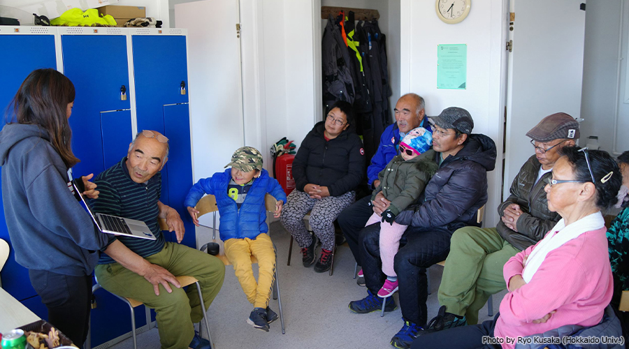
On August 23, Yuta Sakuragi, Monica Ogawa, and Kusaka (Hokkaido University) held a small workshop, which more than ten people attended, about 30 % of the village residents. We asked Ikuo Oshima, who has lived in Siorapaluk for 50 years, to translate for us and introduce our research. Residents asked questions about melting glaciers and seal ecology, making it a valuable time.
(2022/12/22)
Survey of Marine Ecosystem in The Coastal Area of NW Greenland – Marine Mammals and Seabirds
Writer:Mayuko Otsuki (Hokkaido University)
Yuta Sakuragi (Hokkaido University)
The people in the Arctic coast live in close contact with marine mammals and seabirds. These animals provide important food and clothing for them. However, there are concerns about the impact of climate change on these habits and animals. Thus, from July to August 2022, we conducted the studies on the ecology and distribution of marine mammals and seabirds in Qaanaaq and Siorapaluk in northwestern Greenland.
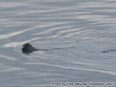
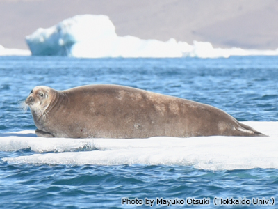
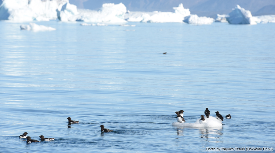
First, we conducted visual surveys of marine mammals and seabirds from vessels ship. We observed ringed seals (Pusa hispida, Fig. 1), bearded seals (Erignathus barbatus, Fig. 2), harp seal (Pagophilus groenlandicus) and narwhal (Monodon monoceros). We also observed seabirds that breed in the Arctic region, such as the little auk (Alle alle, Fig. 3) and the black guillemot (Cepphus grylle). Marine observations were also carried out at the same time such as water temperature and salinity measurements and plankton sampling. We plan to clarify the distribution factors of marine mammals and seabirds.
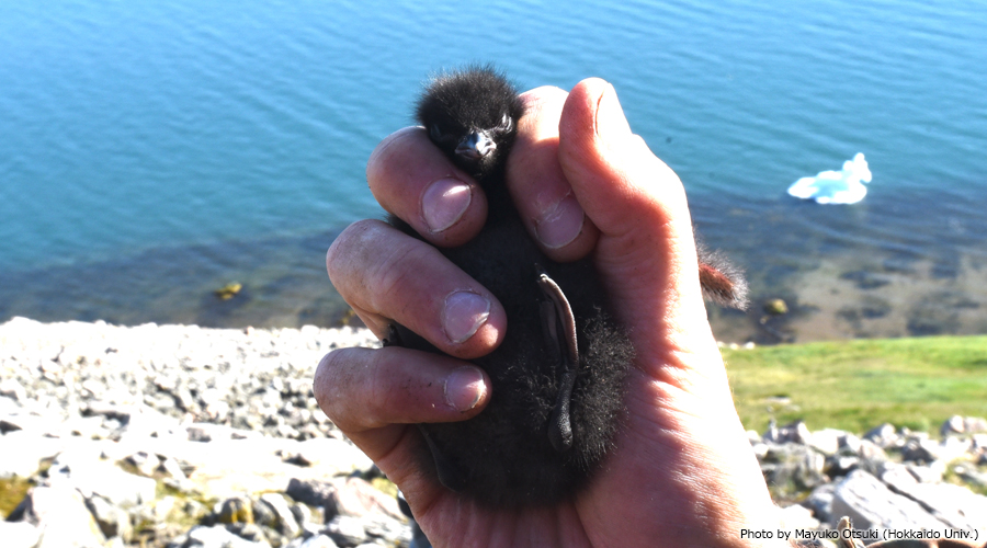
With the help of local hunters, we obtained samples of stomach contents, muscles and livers from seals and seabirds. We plan to investigate their feeding habits and contaminants in the future. At the breeding site of the little auk, we searched for their nests and weighted the chicks (Fig. 4) to understand breeding success.
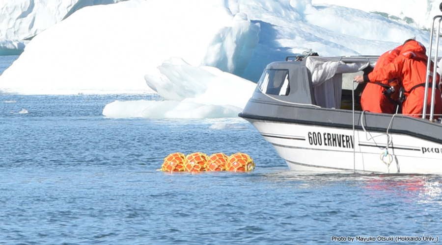
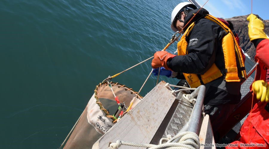
In addition, we successfully deployed five underwater recording devices (Fig. 5) to determine the distribution of narwhals. The presence or absence of narwhal vocalizations indicates their distribution and seasonal variation. These underwater recording devices are scheduled to be retrieved next summer.
(2022/8/25)
Workshop at the Qaanaaq Village, Northwestern Greenland
Writer:Takuro Imazu (Hokkaido University)
Shin Sugiyama (Hokkaido University)
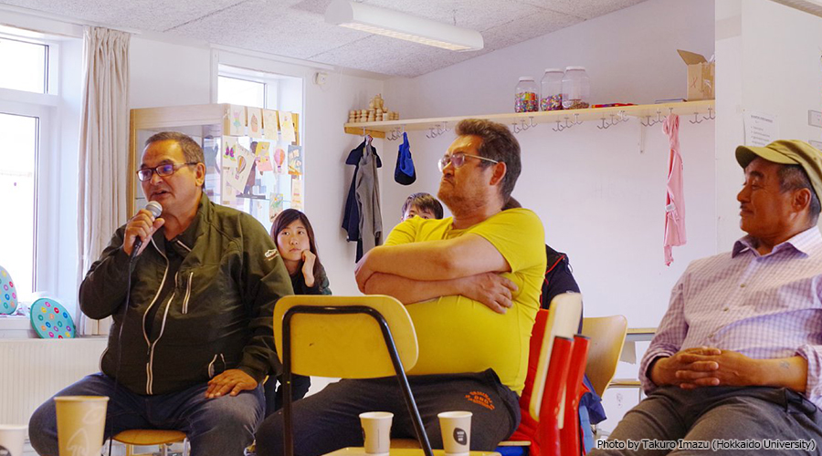
We organized a workshop with residents of the Qaanaaq village on July 31th 2022 (Fig. 1).
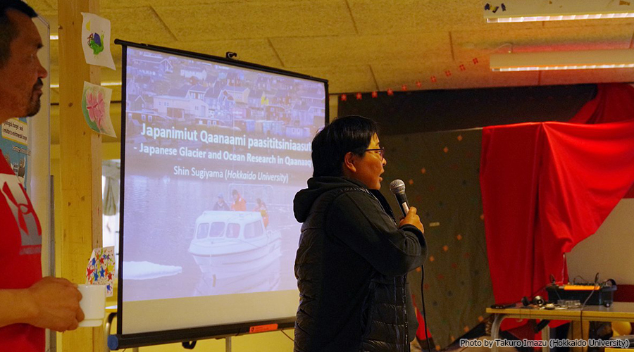
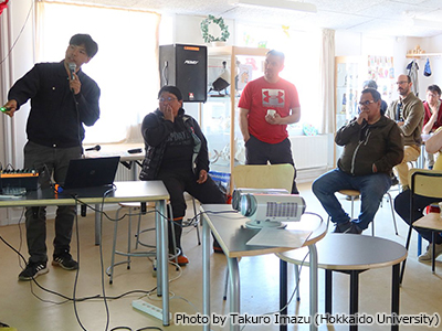
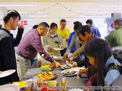
This event has been organized repeatedly since 2016 to introduce our research activities as well as to discuss environmental change in Greenland and future research direction of our project. ArCS II researchers gave talks on glaciers, ocean, marine ecosystem (e.g. narwhals, seals, fish, birds), animal fur and skins used in Greenland (Fig. 2). During a break, workshop participants enjoyed sushi and Japanese snacks, as well as talked about their experience and ideas about environmental changes in the region. It was a great opportunity for us to communicate with local hunters and kids (Fig. 3).
After the presentations by the researchers, we answered questions from the audience and discussed environmental issues. The subject of the discussion includes marine resources (fish and marine mammals), waste management, marine plastic (Fig 4).
People living in Qaanaaq are interested in our research and suggested future research subjects, such as fish migration and possible pollution in the ocean. Moreover, the village people requested us to share research data and publications. To contribute to sustainable future in Greenland, we continue communication with the local community and work together to mitigate the influence of rapidly changing climate and environment.
(2022/8/25)
Survey for Marine Ecosystem in the Coastal Area of NW Greenland – Fishing Gear and Acoustics –
Writer:Makoto Tomiyasu (Hokkaido University)
Kohei Hasegawa (Hokkaido University)
Marine fish is one of the important food resources for people living along the coasts of the Arctic region. To collect information on fish ecology and fishing activities, a survey was conducted from July 17 to August 2, 2022, in the village of Qaanaaq in northwestern Greenland.
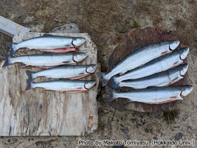
During the summer, anadromous Arctic char (Salvelinus alpinus) migrate from wintering lakes to the sea for foraging (Fig. 1), and people set gill nets (nylon monofilament, 10 cm mesh, 25 m long) in 1-2 m deep water along the coast to catch char (Fig. 2). We investigated the timing of the catch of char in the gill nets and the differences in migration timing by size.
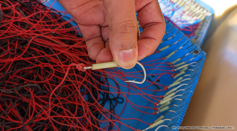
During the winter season when sea ice covers the ocean, bottom longline fishing for Greenland halibut (Reinhardtius hippoglossoides) is conducted, and the characteristics of the fishery were investigated (Fig. 3). Future winter surveys are planned.
In Bowdoin fjord, melting water from calving glacier affects the marine ecosystem. Marine fish and zooplanktons are important as feeds of seabirds and marine mammals that are important food resources for the people living around the area.
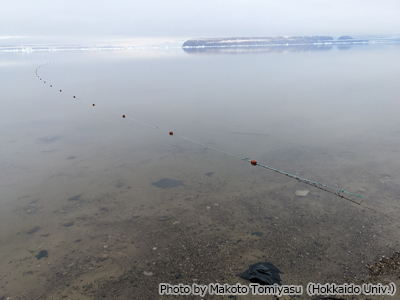
On August 2, 2022, we deployed an acoustic profiler system at a location in Bowdoin fjord to research when and how many marine organisms appear in the area (Fig. 4, 5). The profiler was deployed on the bottom of the site where the water depth was approximately 230 m (Fig. 5 shows the scene before the profiler sank to the bottom).
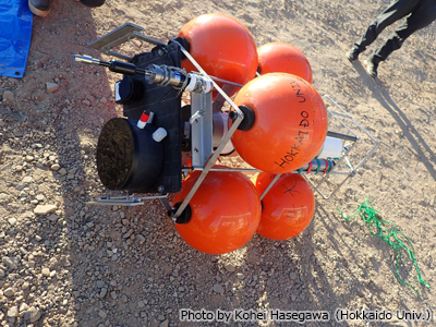
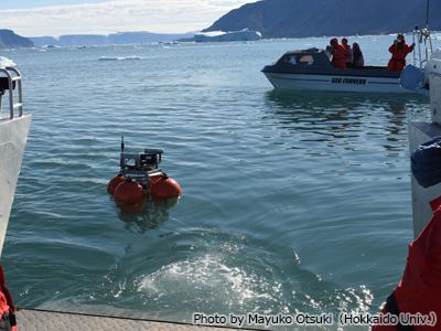
Biological sampling was also carried out using a plankton net to confirm the zooplankton species that were monitored by the acoustic profiler at that time (Fig. 6). The acoustic profiler will continue to collect data for a year, and we will pick it up in summer next year. The knowledge from data of the acoustic profiler is expected to grow understanding the marine ecosystem in the area.
(2022/8/19)
Landslide Survey on Fjord Slopes in the Coastal Area of NW Greenland
Writer:Tatsuya Watanabe(Kitami Institute of Technology)
Shintaro Yamasaki (Disaster Prevention Research Institute, Kyoto University)
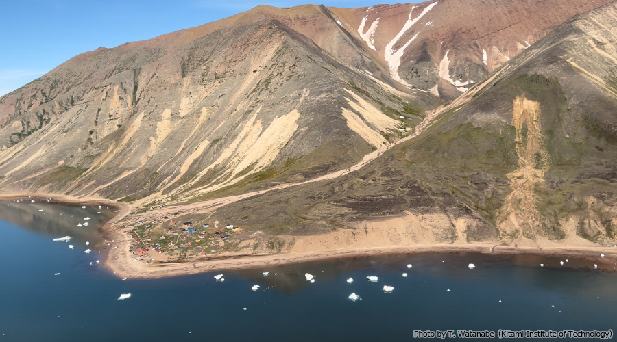
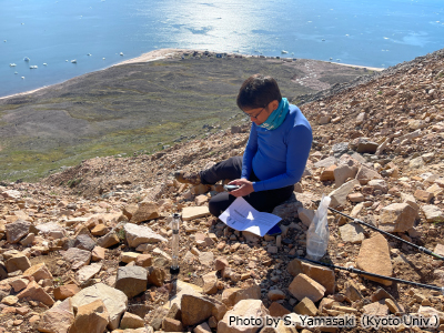
TIn the Arctic region, where rapid climate change is underway, there is concern that landslides could occur more frequently due to permafrost thawing and increased rainfall. In Siorapaluk, the northernmost settlement of Greenland, many huge shallow landslides caused by heavy rain occurred in the summers of 2016 and 2017 (Fig. 1). The physical properties of the periglacial sediments, which thickly cover steep slopes, probably contribute to slope failures. In this summer’s survey, permeability tests and grain size analyses were carried out on the failed slopes to understand the mechanism of the landslides (Fig. 2). As the surface and subsurface structures in periglacial environments differ from those in temperate regions such as Japan, shallow landsliding mechanism is expected to be totally different. Thus, it is important to elucidate the detailed processes to estimate hazard risk for Arctic landslides.
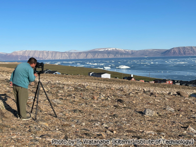
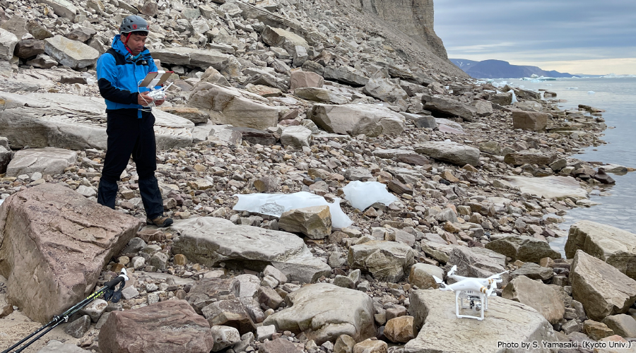
Gravitational slope deformation is developing on fjord high cliffs due to the stress changes following glacier retreat. Eventually, huge rock failures will occur, and accompanying tsunamis will hit nearby settlements. High-resolution DEM shows the possibility of gravitational slope deformation related to destabilization on fjord slopes around Qaanaaq, the largest settlement in NW Greenland. In this summer’s survey, the fjord slopes were photographed with a super-telephoto lens camera to understand the wide range of geological structures around Qaanaaq (Fig. 3). Close-up photography with a drone and visual observation from a fishing boat were also carried out, focusing on areas of slope instability (Fig. 4). We are analyzing large-landslides and induced tsunami risk by obtaining new image data.
(2022/8/3)
How Does Meltwater Come Out from a Glacier in Greenland?
Writer:Masahiro Minowa (Hokkaido University)
Ken Kondo (Hokkaido University)
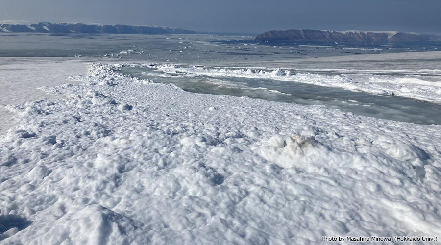
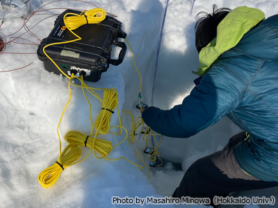
The recent rapid warming caused an increase in the melting of the Greenland Ice Sheet, resulting in an increase in runoff into the ocean. However, much of the melted water may be retained by refreezing in the accumulation area of the ice sheet where ice is covered by snow, and it could be reducing the runoff. To investigate the relationships between melting, refreezing, and runoff in the Greenland Ice Sheet, we performed in-situ observations in Qaanaaq Glacier in northwestern Greenland from July 3 to 23 2022 (Fig. 1).
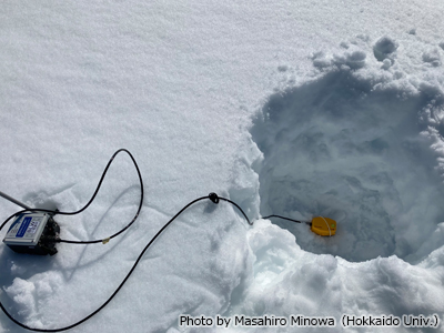
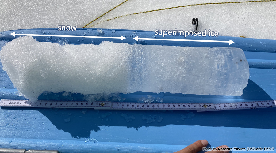
In addition to the surface mass balance monitoring which we have been continuing for a decade, we newly deployed thermistors, conductivity sensors, and geophones within a snow/ice in the accumulation area of the glacier (Figs 2 and 3). Several shallow snow/ice cores were also taken, and we found that meltwater was refrozen indeed under the snow layer (Fig. 4).
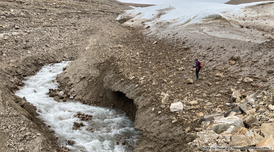
By comparing meltwater runoff from the glacier and the processes occurring at the accumulation area, we are going to understand how meltwater comes out from a glacier and the influence of the recent warming for the runoff from the Greenland Ice Sheet (Fig. 5).
(2022/7/27)