We conducted meteorological and hydrographic surveys including marine biogeochemical samplings in the northern Bering Sea and the Arctic Ocean on board the R/V Mirai from 22 August to 5 October 2016 under the Arctic Challenge for Sustainability (ArCS) Project.
Although the Arctic sea ice in 2016 hit the second-lowest level in recorded history, sea ice remained in the northern Chukchi Sea (Figure 1 and Photo 1) and disrupted our research plans. However, we managed to complete the observations in some focused areas where physical, chemical, and biological processes are sustaining unique marine environment and ecosystem that might be influenced by the recent Arctic warming and sea ice reduction.
For example, a biological hotspot in the waters off Point Hope is one of the focused areas. In this region, spring blooms are brought about by the nutrients supplied from the Bering Sea, and fall blooms are maintained by the nutrients regenerated from the organic particles accumulated at the sea floor. New instruments deployed here during Green Network of Excellence project (GRENE Arctic) indicated seasonal changes in zooplankton, and the changes might be associated with migration of sea birds. We have also reported aragonite undersaturation in the bottom water off Pt. Hope, and anthropogenic CO2 has significant impact on the duration of undersaturation. For further studies, we carried out detailed oceanographic observations (Photo 2), bottom sediment samplings (Photo 3) and a mooring deployment (Photo 4) in this year’s cruise.
Another focused area is the Barrow Canyon, where we have deployed moorings tomonitor the heat and freshwater fluxes of Pacific-origin water that may impact on the sea ice distribution and ecosystem in the Canada Basin. Chukchi shelf slopes and the Canada Basin are also important regions to understand the shelf-basin interaction and its impact on ecosystem in response to meteorological conditions. Thus, we set some hydrographic sections in these regions. In this cruise, we had 148 oceanographic stations including 85 water sampling sites, 68 plankton net sites, 23 sediment sampling sites, 2 sites for drifting buoy launches, 5 sites for recoveries and 8 sites for deployments of moorings and sediment traps (Figure 2). These missions were successfully completed thanks to great efforts made by the captain, ice pilot, officers, crew, and all the participants in this cruise (Photo 5). Based on the data obtained in this cruise, we will be able to shed light on the Arctic change and its controlling factors, and will contribute to the global climate change studies.
Shigeto Nishino (JAMSTEC / A member of Theme 4)
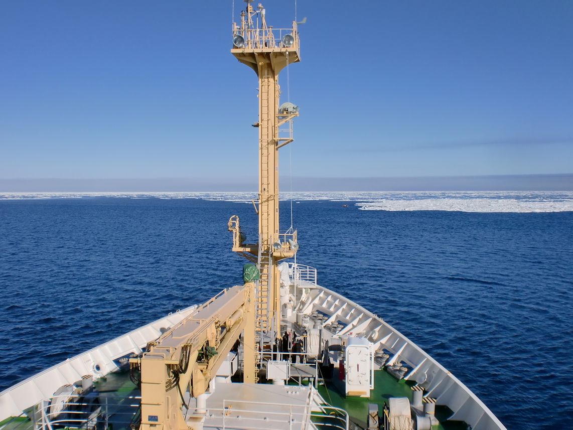 Photo 1: View of sea ice from the bow of R/V Mirai off Pt. Barrow, Alaska (71°25’N, 158°40’W).
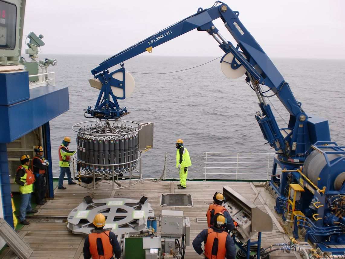 Photo 2: Oceanographic observation using Conductivity-Temperature-Depth (CTD) sensors and water sampling bottles.
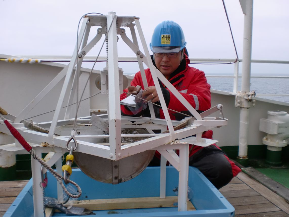 Photo 3: Bottom sediment sampling using Smith-Mcintyre grab (S&M grab).
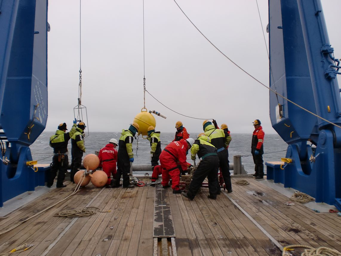 Photo 4: Mooring deployment off Pt. Hope, Alaska (68°02’N, 168°50’W).
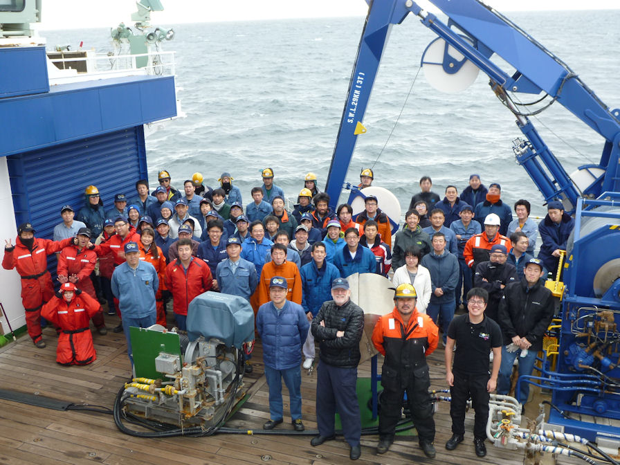 Photo 5: Commemorative photograph for the participants of R/V Mirai Arctic Ocean cruise in 2016.
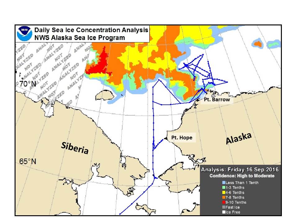 Figure 1: Sea ice concentration and cruise tracks in the research area
Colors indicate sea ice concentration on 16 September 2016. The data is obtained from Daily Sea Ice Concentration Analysis, NWS Alaska Sea Ice Program, NOAA. Blue lines represent the cruise tracks of R/V Mirai.
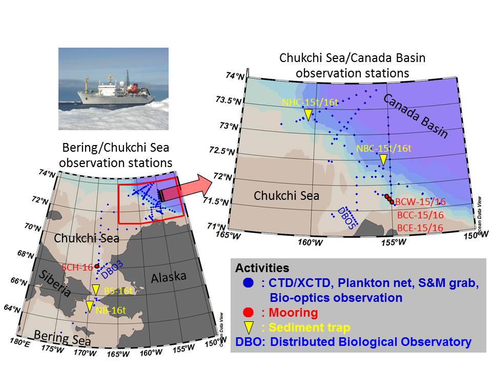 Figure 2: Summary of research activities during the R/V Mirai Arctic Ocean cruise in 2016
Map of the research area in the northern Bering Sea and the Arctic Ocean (left) and an enlarged drawing from the Chukchi shelf slope to the Canada Basin (right). Blue dots indicate stations where we conducted observations using Conductivity-Temperature-Depth (CTD) sensors with water sampling bottles, eXpendable Conductivity-Temperature-Depth (XCTD) sensors, plankton nets, Smith-Mcintyre grab (S&M grab), and bio-optics instruments. Red dots and yellow triangles represent mooring and sediment trap sites, respectively. We also carried out intensive oceanographic surveys under an international collaboration (Distributed Biological Observatory) off Pts. Hope and Barrow.