During this summer‘s cruise of the Japanese research vessel R/V Mirai extra radiosondes have been launched as a contribution to YOPP. As part of the Japanese research project Arctic Challenge for Sustainability (ArCS), extra radiosondes were launched every six hours over the ice-free Chukchi Sea during September 2017 aboard the R/V Mirai (Figure 1, 2.)
In addition to radiosondings, a global cloud-resolving model(Non-hydrostatic Icosahedral Atmospheric Model: NICAM) was run to provide a quasi-real time forecast for the operational support of navigating R/V Mirai through Arctic waters. Although NICAM still needs to be tuned for specific meteorological phenomena occurring in the Arctic, certain weather events were well detected and helped to improve their forecasts. Being associated with a developing low pressure system evolving over the Chukchi Sea(Figure 3), precipitation detected by a shipboard scanning Doppler radar (Figure 4) and surface wind recorded at 20 m/s (Figure 5) on September 13 could for example already be well predicted two days earlier by the model-driven forecast initialized at 0000UTC(Figure 6). The hurricane Irma that took place from 5–11 September has been of wide international awareness due to its powerful damaging impact to the Caribbean Sea and the South of the United States. With regard to activities on board R/V Mirai, Irma can be taken as a suitable case showing that the impact of YOPP observations together with the tropical special dropsondes close to the hurricane can reveal much improved forecast precision. Since the hurricane was associated with a deep atmospheric trough that extended from the north of Alaska to the south of the United States, extra radiosondes from R/V Mirai probably contributed to detecting the event well in advance and thus helped to improve the hurricane forecast(Figure 7).
By using an ensemble data assimilation system developed by the Japan Agency for Marine-Earth Science and Technology (JAMSTEC), data denial experiments will be carried out in the near future in order to estimate the particular degree of improvement to the forecast of events as such these two examples.
Jun Inoue, NIPR(Principal Investigator(PI) of Theme 1)
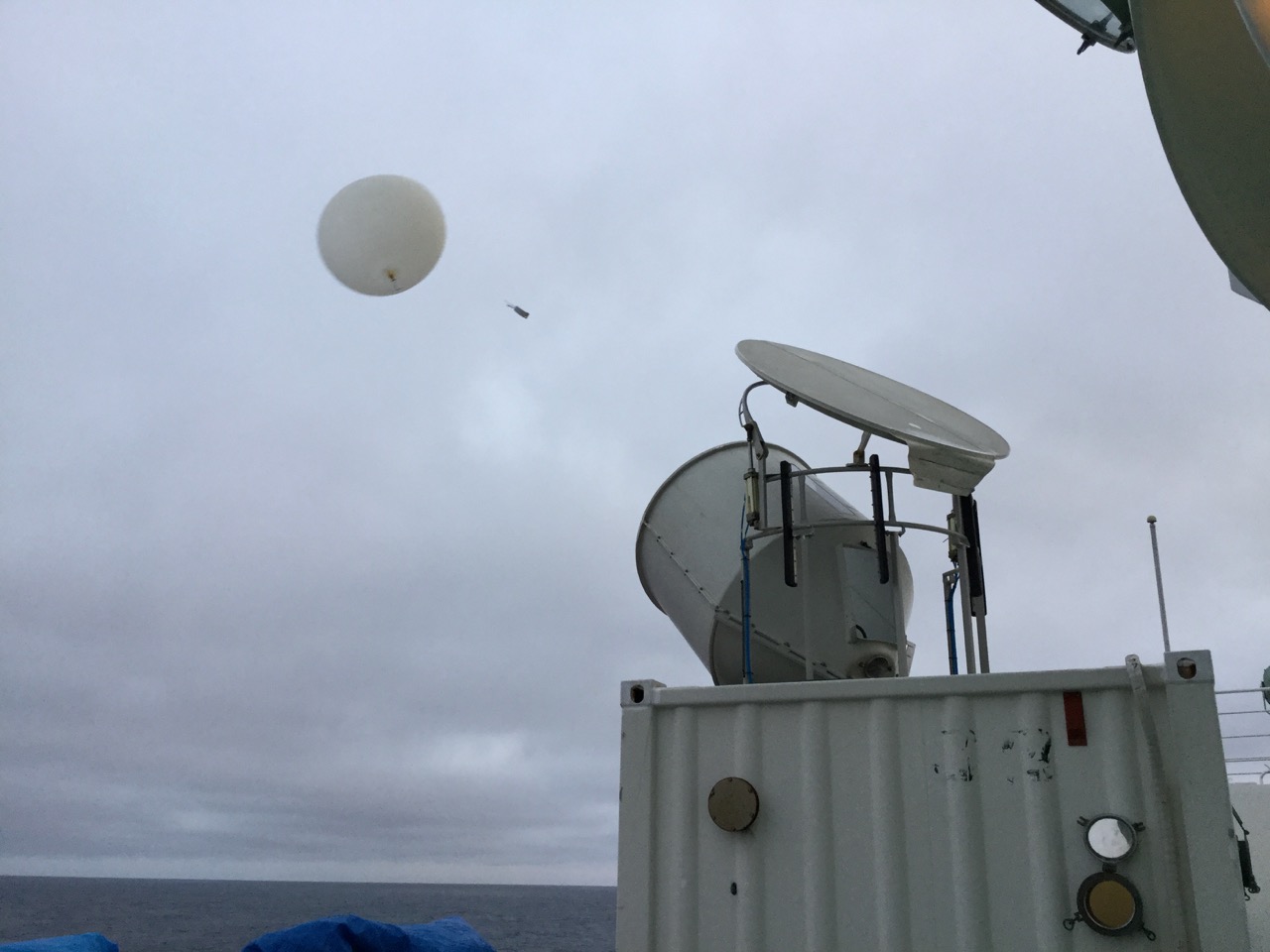 Figure 1: Radiosonde observations from R/V Mirai
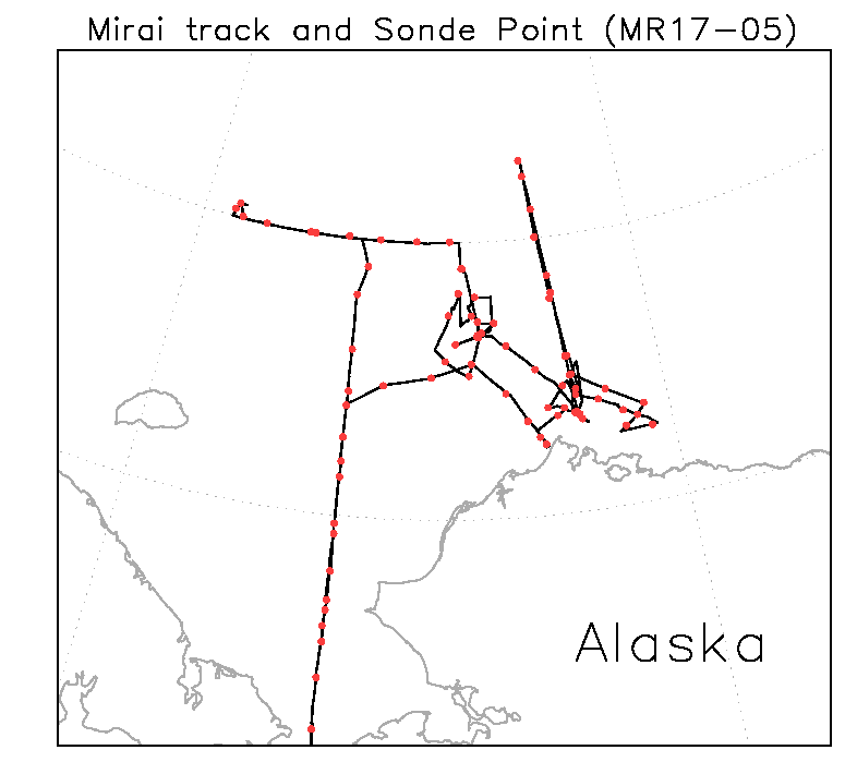 Figure 2: The cruise track and the radiosonde observation points of R/V Mirai
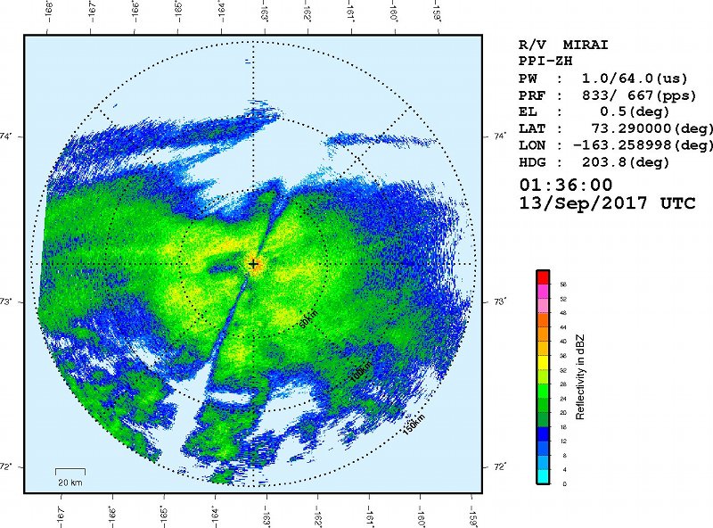 Figure 3: Low pressure system evolving over the Chukchi Sea by AVHRR
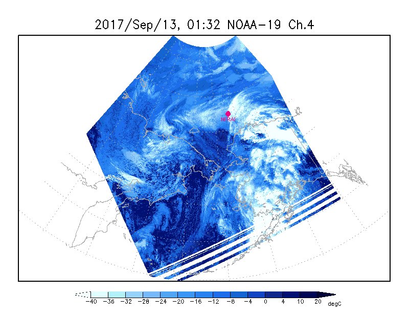 Figure 4: Precipitation detected by a shipboard scanning Doppler Radar
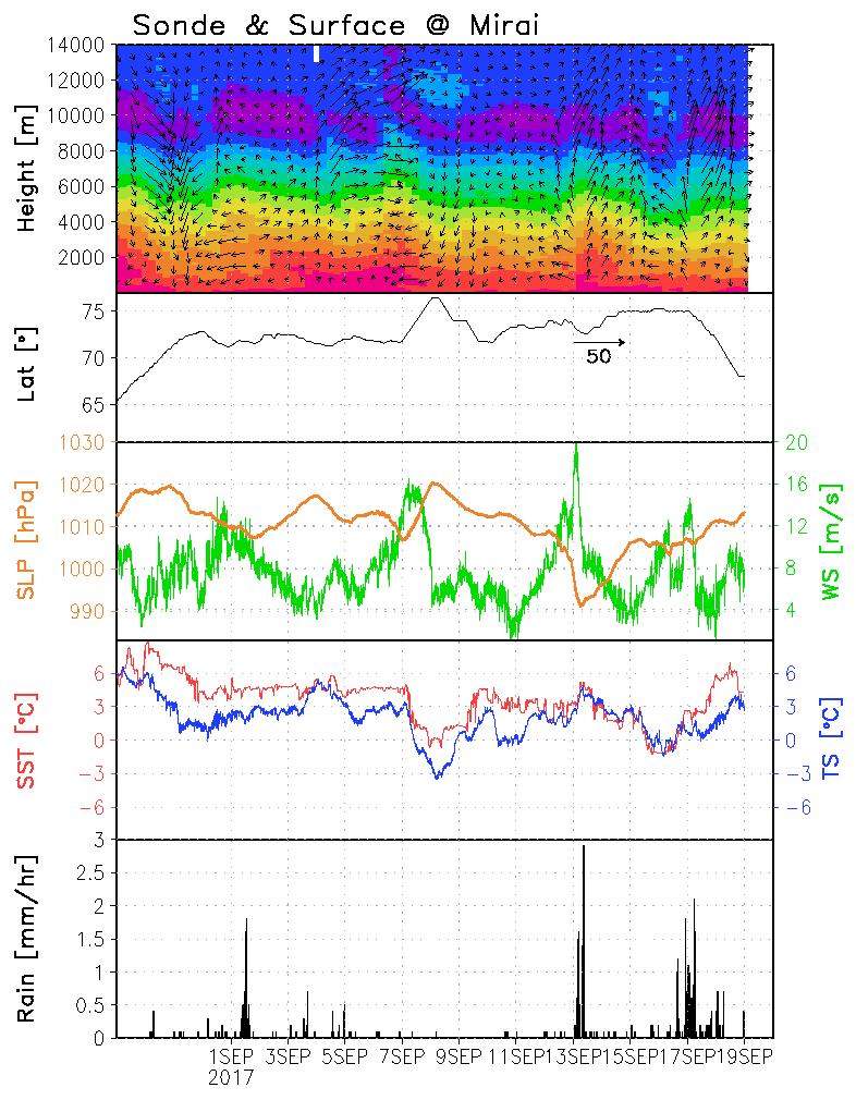 Figure 5: Time series of meteorological parameters obtained by R/V Mirai. Strong wind speed (20 m/s) was recorded on 13 September associated with a passage of a low pressure system (the 3rd figure).
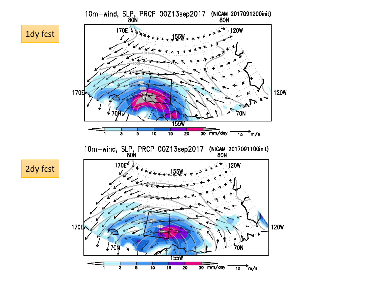 Figure 6: Sea level pressure, precipitation and winds predicted by NICAM. (top: 24-hour forecast; bottom: 48-hour forecasts).
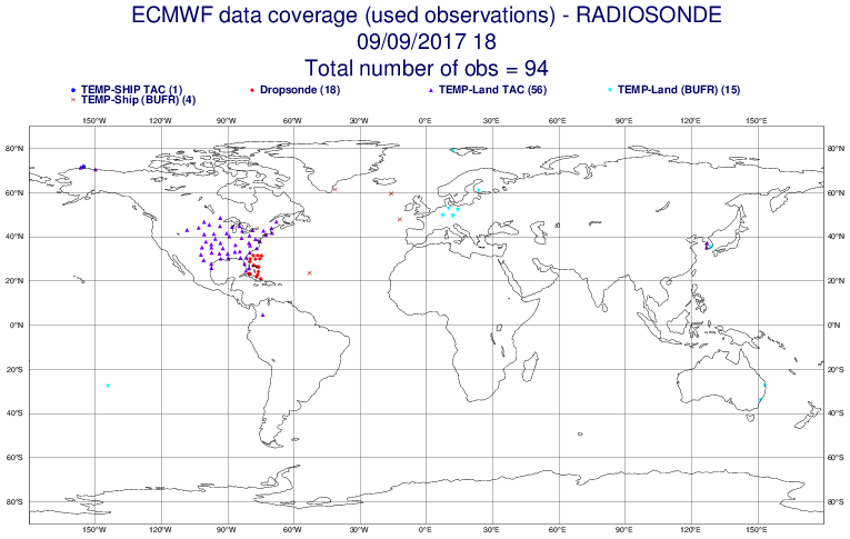 Figure 7: A global radiosonde observation map provided ECMWF. Extra radiosondes from R/V Mirai likely contributed to improve the forecast of the catastrophic hurricane Irma in September 2017.
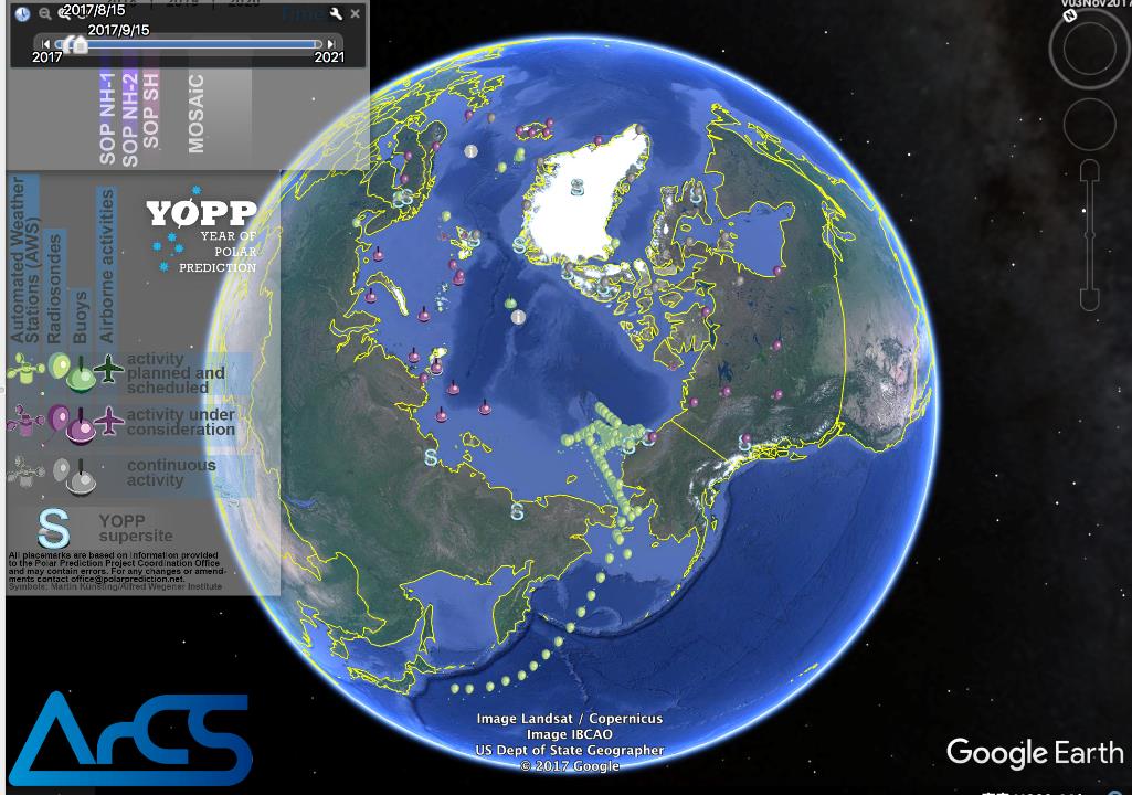 Figure 8: YOPP Observations Layer provided by PPP/YOPP, including the radiosonde observation points of R/V Mirai