Around the middle of September every year, the Arctic sea ice extent reaches its lowest point in the year. According to the data from JAXA’s Earth Observation satellite "SHIZUKU" (GCOM-W1), the minimum extent for this year is expected to be the second lowest in the satellite record. The Arctic sea ice extent graph provided by Arctic Data archive System (ADS) shows that the extent for the beginning of September is already lower than the minimum extent in 2007, which has been the second lowest until now.
Although the ice extent is getting lower as of 8 September 2016, it is not expected to be lower than the minimum extent in 2012, the lowest ever recorded. This prospect is based on that the extent on 3 September 2016 was 4.05 million square kilometers, whereas the minimum extent in 2012 was 3.18 million square kilometers (i.e., 0.87 million square kilometers lower than 3 September 2016). For September, the greatest monthly ice loss ever recorded is 0.45 million square kilometers, which was in 1991. It is therefore unlikely that the minimum extent for this year will reach a new record.
On ADS website, you can see quasi-real-time observation data of Arctic sea ice acquired by the satellite “SHIZUKU”.
Hironori Yabuki, NIPR
(Principal Investigator of the "Arctic Data archive System" research program)
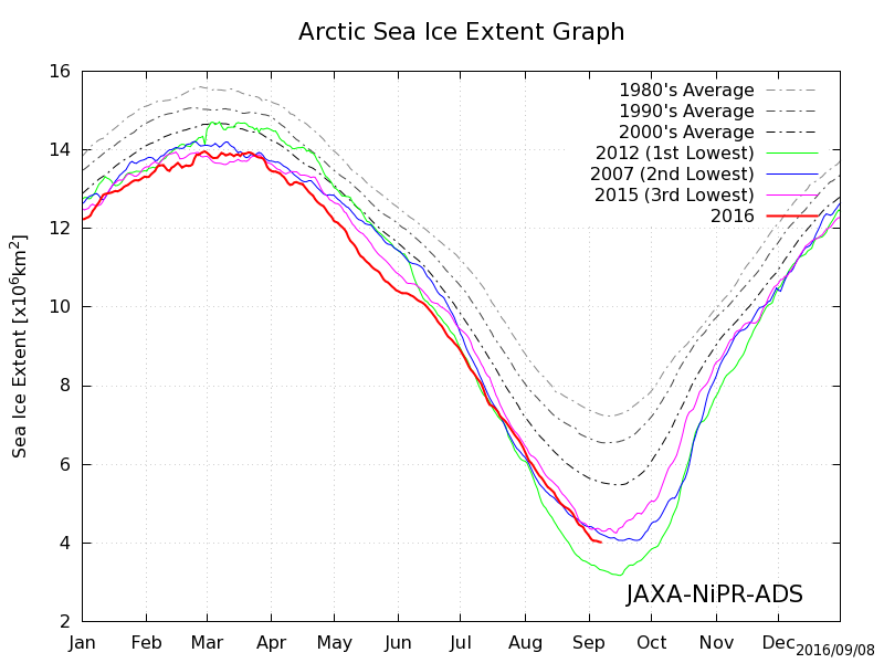
Arctic sea ice extent graph as of 8 September 2016
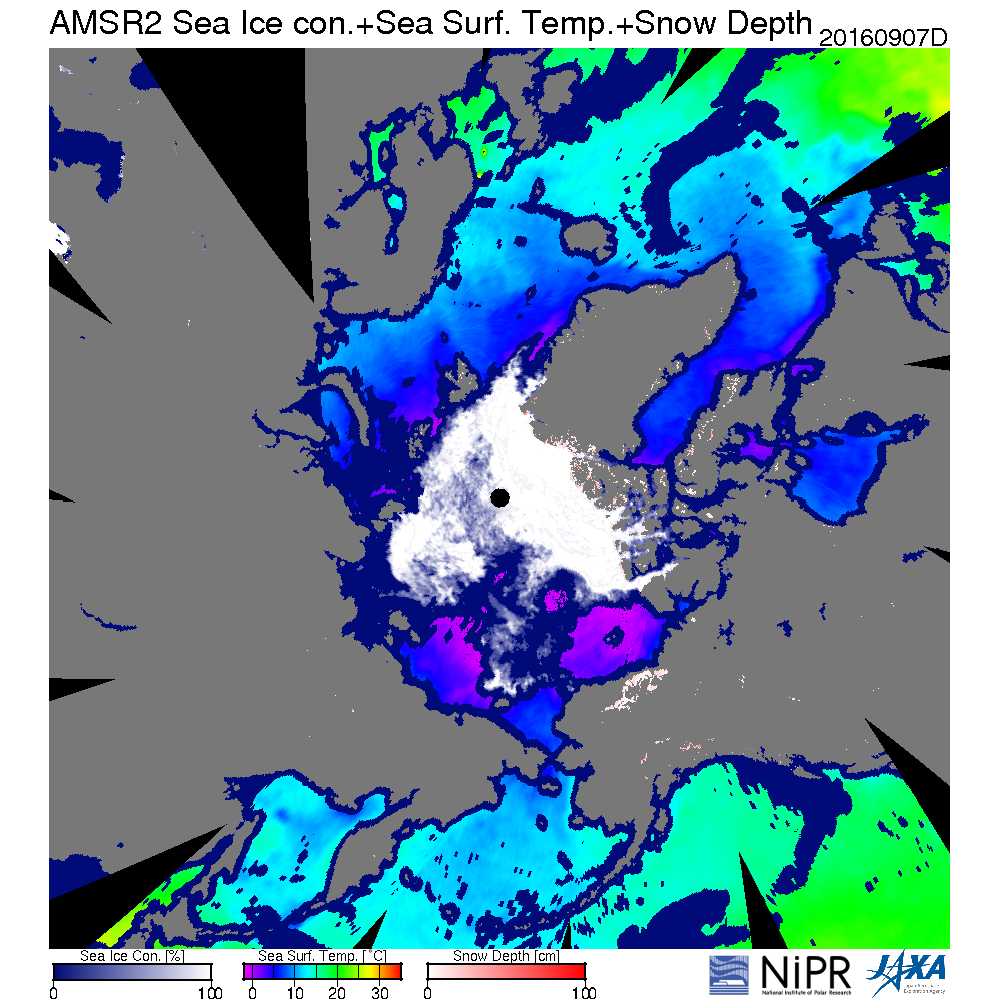
Composite image of Arctic observation data as of 8 September 2016 including sea ice concentration
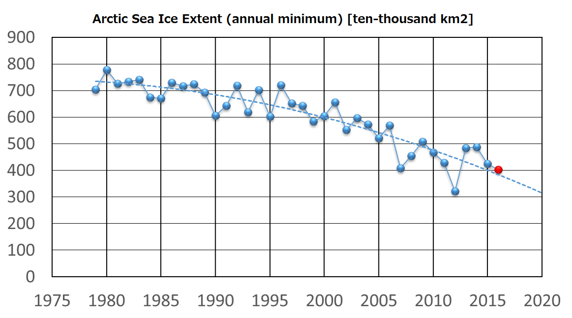
Arctic sea ice extent graph showing every annual minimum